Design and rendering of roads and landscapes in ASCII art from topographic data
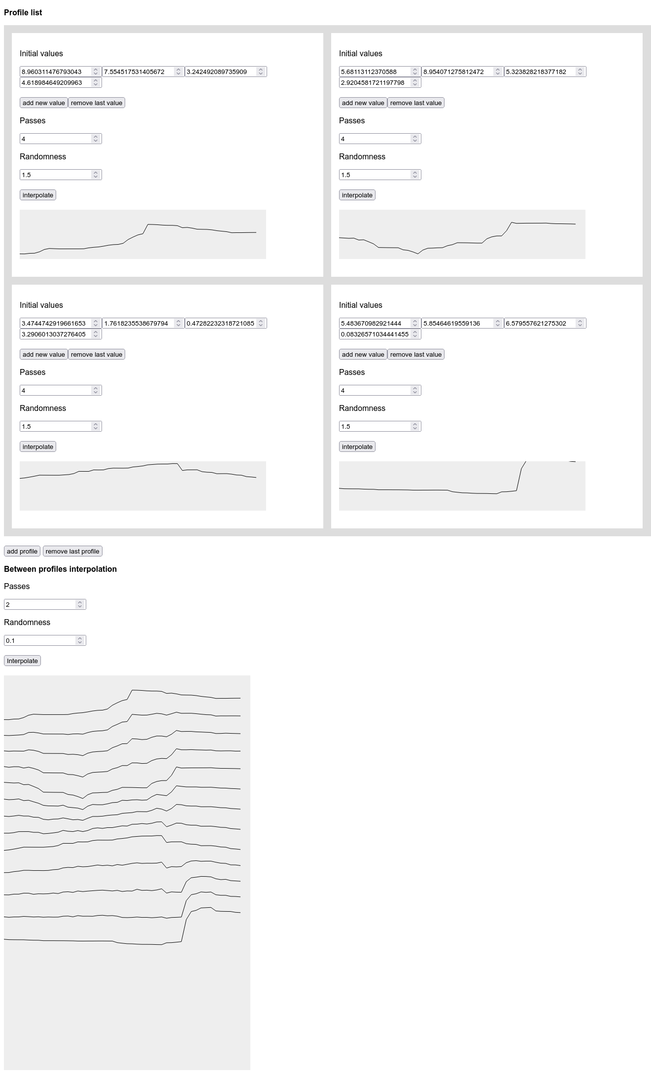
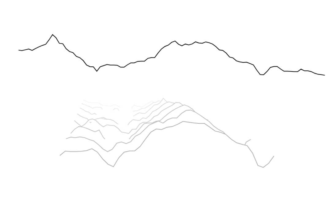
With Vincent Maillard, we worked on how to build and render the road and its background landscapes in The Wind Though the Wheels. Using the “ascii smooth lines” system I introduced last month, we focused on approaching the landscape as layers of relief profiles projected into space.
We created some sort of shader that renders ASCII relief volumes using arrays of 2D coordinates projected into space. The first two relief arrays in the data are used for the roadside.
Once the 3D environment of the scene is in place, it’s a matter of finding the right XYZ scale, balancing geographical realism, the length of the race, the difficulty and the relevance of the viewpoint. Perhaps these factors will be something that the player can modify during the game as special powers or abilities?
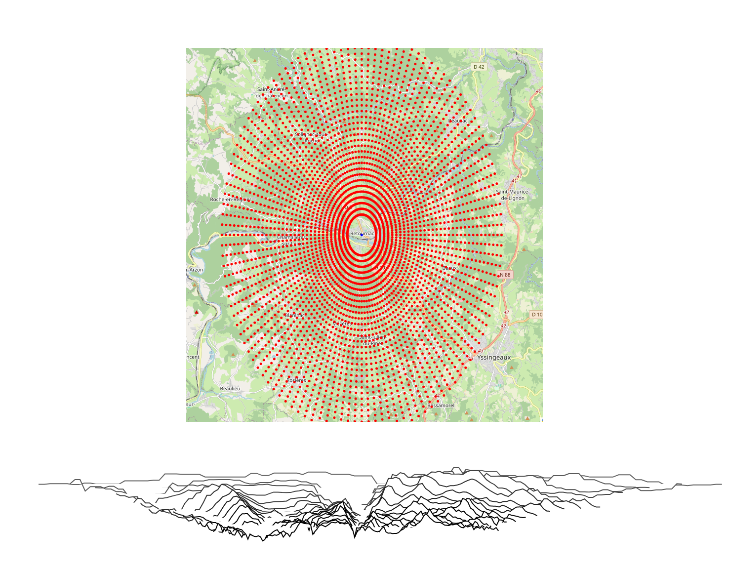
Beyond the rendering of roads and landscapes, there is the issue of their design. It’s quite difficult to create consistent landscape data by hand, so we started using data from Open Elevation. As a test, we used it to model the relief around Retournac, a town near where we live.
Using existing rides (from Open Runner data) as a starting point for designing stages is a neat aspect of the method.
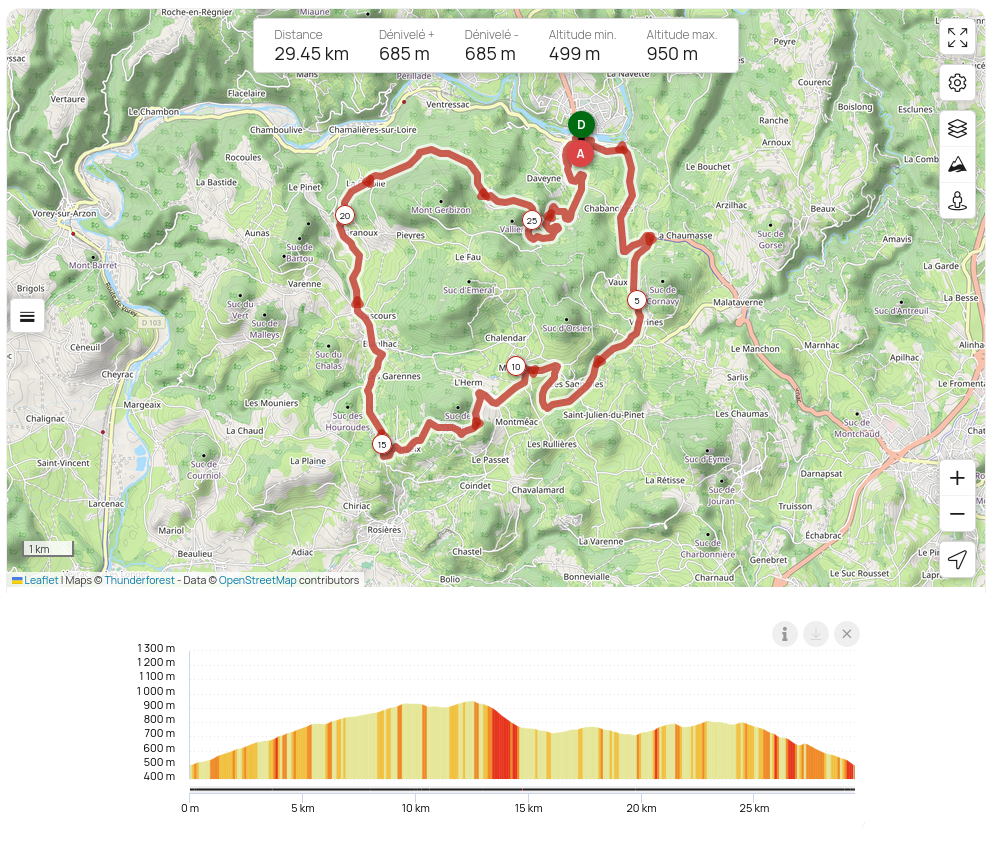
However, our way of visualising cycling from a side view means that we flatten out the road from all its bends, so we can’t build a coherent stage from unmodified geographical data. We will design stages by modifying and interpolating cycle route reliefs and selected or generated landscapes that are not geographically coherent at first.